MoRPh is a river habitat survey technique which records both the physical habitat and hydromorphological functions within the river or stream.
The MoRPh technique includes many components of the Environment Agency’s River Habitat Survey (RHS, 2003) and so provides compatible information. It also provides a more detailed local picture of a river and its margins, and is more accessible for citizen scientists.
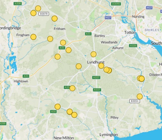
With support from trained citizen science volunteers, Forestry England has used the MoRPh technique to collect information from a range of habitat locations in the New Forest, including before and after wetland restoration works.
The MoRPh field survey sheet is used to record all field data observations and measurements along a 200-metre survey section. Surveyors stop every 20 metres to collect data, including fixed point photographs for each 20m cross-section.
Forestry England has used the Modular River Physical survey (MoRPh) technique to survey a variety of sites on different watercourses across the New Forest
https://modularriversurvey.org/morph-rivers
MoRPh Rivers Citizen Science Copyright Cartographer Studios (https://cartographer.io) and Modular River Survey (https://modularriversurvey.org) contributors